Pictures from fieldwork in Morocco
 |
|
Background In the late 1980s, Alison Geist and I worked with the Moroccan Ministry of Agriculture studying a Berber (Tashelhait-speaking) confederation called the Imeghrane in the High Atlas mountains and pre-Saharan plains east of the provincial capital of Ouarzazate. The roughly 45,000 Imeghrani-s continue to practice traditional forms of irrigated agriculture (growing barley, alfalfa, vegetables, and a little corn), arboriculture (dates in the plains, almonds in the foothills, and walnuts in the mountains), and "transhumant" pastoralism. Population growth of about 400% in this century has made it impossible for most households to support themselves from these subsistence activities. About a tenth of the households have a young man working as a "guest worker" in Europe, and most have sons who work in Morocco's large cities and help support their families. But Moroccan wages are so low ($3 - $5 per day for most labor) that few men can afford to move their families from their village homes and pay the costs of city living -- so most households survive by combining wage labor in cities with subsistence agriculture and pastoralism in the countryside. Improving the quality of life in the countryside will benefit the women, children, and older people who remain there while the young men work elsewhere. It also can slow the exodus to the sprawling cities and the growth of urban slums where many families live when they leave the countryside. |
||
|
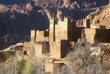
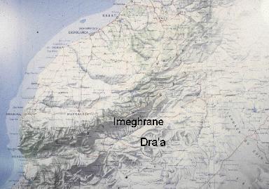
To help the Livestock Service develop a rangeland replanting and pasture management project, we studied household, village, and "tribal" organization, the economics of pastoralism and agriculture, systems of water and pasture rights. We chose to compare three villages in order to capture the diverse ecological settings within the Imeghrane's roughly 50 mile by 40 mile territory: Assaka on the plains; Toundout (where we lived) in the foothills, and Tamzrit in the High Atlas. These pictures are from the region. Morocco Map:
The Imeghrane confederation lies mostly on the Saharan side of the
High Atlas Mountains, and includes the Dades Valley just East of
Ouarzazate (the provincial captial, locatd just below the "m"
im Imeghrane on the map), and pastures in the Saghro Mountains.
Here are pictures
we took of the Ouarzazate area, including the date palm oases lining
the Dra'a River (which flows south from Ouarzazate and disappears
into the Sahara), and villages and pastures ofImeghrane. Many are
of Toundout, where we lived. |
|
|
I'm putting some pictures of Rabat, Marrakech, and other areas here.